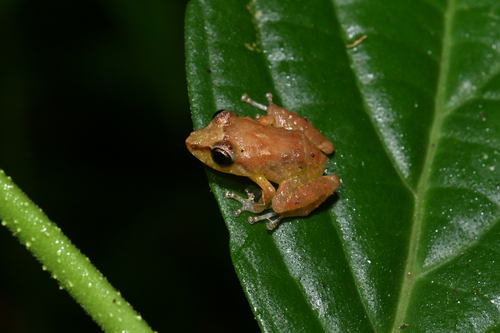
Bloody Bay Poison Frog

Bloody Bay Poison Frog

Mannophryne olmonae

Silhouette: Dmitry Bogdanov (vectorized by T. Michael Keesey) · PhyloPic

LCNTVUVulnerableENCR Endemic
Daily sighting probability ~30% · Possible
at Main Ridge Forest Reserve

In 3 days ~60% in a week ~90%

13 Verified sightings at Main Ridge Forest Reserve From 2019 to 2026
13 In 1 park
November Best month
☀️🌙 Day & Night When it's spotted

About the Bloody Bay Poison Frog

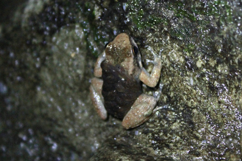
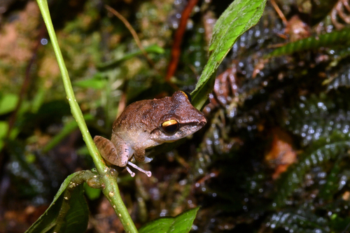
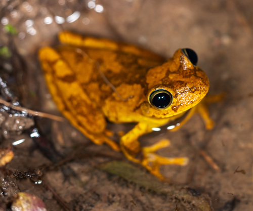
The Bloody Bay poison frog or Tobago poison frog (Mannophryne olmonae) is a species of frog in the family Aromobatidae. It is endemic to Tobago Island and Little Tobago Island in Trinidad and Tobago. The adult male frog measures 21.0 mm ± 2.4 mm in snout-vent length and the adult female frog 21.6 mm ± 2.2 mm. The skin of the dorsum is brown in color. There is a green mark in the shape of the letter X on the back that connects to the interorbital area. There is a mark in the shape of the letter V on the back nearer the posterior end. There is a light brown stripe edged in gray and a yellow stripe, also edged in gray, on each side of the body. The upper surfaces of the legs are light brown in color with dark marks and two yellow marks. There is yellow pigmentation on the belly.

This frog lives near streams in forests. Almost all of the forests in Tobago are secondary forests, former cacao plantations that have been growing back since the early 20th century. Scientists saw the frog between 30 and 4900 meters above sea level.

One of the places the frog lives is a protected rain reserve called Tobago Main Ridge Forest Reserve. The male... Wikipedia →

Sounds

Advertisement call0:11

Trinidad & Tobago · 2019

© Chris Harrison · XC892921 · CC BY-NC-SA 4.0

Recording0:11

Trinidad & Tobago · 2025

darrenmclaughlin · iNaturalist · CC0

Global Distribution

Parks Where Found

# Park Country Daily sighting probability
1 Main Ridge Forest Reserve 🇹🇹 Trinidad and Tobago
~30%

More parks will be added in future updates.

Before you go

What are the chances of seeing a Bloody Bay Poison Frog in Main Ridge Forest Reserve?

Possible

About 30% of wildlife watchers report a Bloody Bay Poison Frog sighting in Main Ridge Forest Reserve on a given day, based on 13 verified sightings from GBIF citizen-science data from 2019 to 2026. It is the 9th most-seen of the 10 amphibians we can rate there. Over three days the chance rises to about 60%, and over a week to about 90%, if each day is a fresh chance.

When is the best time to see a Bloody Bay Poison Frog in Main Ridge Forest Reserve?

November

In that month about 60% of wildlife watchers report a Bloody Bay Poison Frog in Main Ridge Forest Reserve on a given day, against under 5% in February–March, May and August–October, the lowest months. That is one of Main Ridge Forest Reserve's wettest months, with about 210 mm of rain against 60 mm in February.

What time of day is best to see a Bloody Bay Poison Frog?

Between 10 am and 1 pm

Across all the parks we cover, that three-hour window holds the most Bloody Bay Poison Frog sightings with a recorded time, and about 7 in 10 of them come between 6 am and 6 pm: it is seen both by day and at night.

Where else can you see a Bloody Bay Poison Frog?

Only Main Ridge Forest Reserve, in our data

Main Ridge Forest Reserve is the only park on Wallace's Line with enough records to rate Bloody Bay Poison Frog sightings: about 30% of wildlife watchers there report one on a given day.

Which relatives of the Bloody Bay Poison Frog live in Main Ridge Forest Reserve?

Same order: Anura

The closest relatives of the Bloody Bay Poison Frog that you can see in Main Ridge Forest Reserve (order Anura, Frogs and Toads) are Eastern Cane Toad (about 60%), Charlotteville Robber Frog (about 50%) and Smooth-skinned Ditch Frog (about 50%), with each one's daily chance of a sighting.

Where does the Bloody Bay Poison Frog sighting chance come from?

GBIF citizen-science records

It is estimated from how often the Bloody Bay Poison Frog is recorded against all the amphibians logged in Main Ridge Forest Reserve (13 verified sightings from 2019 to 2026), calibrated against known sighting rates. Figures are rounded to the nearest 10% because citizen-science data supports honest approximations, not decimals, and months with records from fewer than five people show "—". How it works.

← Back to Main Ridge Forest Reserve