Zoo
Mysore Zoo
🇮🇳 India
🦒 Zoo or wildlife park, India 77 spp. present
Mysore Zoo (or Mysuru Zoo), officially known as Sri Chamarajendra Zoological Gardens, is a composite of zoological gardens and animal park located in the southern Indian city of Mysore, Karnataka. Stretching across a 157-acre (64 ha)-expanse and situated at about 700 metres (0.43 miles) from Mysore Palace, it is the oldest zoo in India and one of the oldest in the world. One of the most popular zoos in India and one of the city's most popular attractions, it is home to a wide range of over 168 species. Wikipedia (CC BY-SA)
12.301° N 76.668° E
🎟️ Visit

Essentials
Entrance
—
Tourism
High
Species present
77
speciesOpened
1892
Size
Large
Visit
Getting there
What visitors say
🦒 Animals in captivity




Before you go
Where is Mysore Zoo?
Mysuru, India
Mysore Zoo is a zoo or wildlife park in Mysuru, India. Its coordinates are 12.301° N, 76.668° E. The nearest national park in our atlas is Nagarhole National Park, about 65 km away.
What animals can you see at Mysore Zoo?
77 species
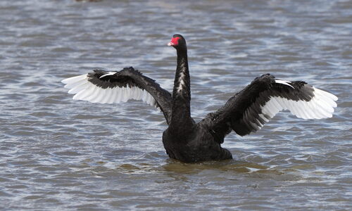
Citizen-science photos record 77 species at Mysore Zoo, including Axis Deer, Black Swan, Common Peafowl, Great White Pelican and Reticulated Python. Those with a page of their own in our atlas show the odds of seeing them in the wild.
Where can you see the animals of Mysore Zoo in the wild?
Axis Deer: Wilpattu National Park
Some of the animals photographed at Mysore Zoo also live in the parks and cities we cover: Axis Deer (about 90% of wildlife watchers report it on a given day in Wilpattu National Park), Black Swan (about 40% of wildlife watchers report it on a given day in Gauja National Park) and Common Peafowl (about 90% of wildlife watchers report it on a given day in Udawalawe National Park).
When did Mysore Zoo open and how big is it?
Opened 1892, 35 ha
Mysore Zoo, a zoo or wildlife park in Mysuru, India, opened in 1892 and covers about 35 ha, according to Wikidata and OpenStreetMap. Today 77 species are photographed there.
Nearest Zoos & Centres


Nearest Parks


Nearest Cities


Sources: © OpenStreetMap contributors (ODbL) · Wikidata (CC0) · iNaturalist observers · Wikipedia (CC BY-SA)