Zoo
The Wildlife Habitat
🇺🇸 United States
🦒 Zoo or wildlife park, United States 42 spp. present
36.117° N 115.171° W
🎟️ Visit

Essentials
Entrance
Free
Tourism
High
Species present
42
speciesOpened
—
Size
Small
Visit
Opening hours
Every day · sunrise to sunset
Getting there
- Access
- Wheelchair accessible
Who runs it
- Run by
- Flamingo Hotel and Casino
What visitors say
🦒 Animals in captivity






Before you go
Where is The Wildlife Habitat?
Las Vegas, United States
The Wildlife Habitat is a zoo or wildlife park in Las Vegas, United States. Its coordinates are 36.117° N, 115.171° W. The nearest national park in our atlas is Death Valley National Park, about 194 km away.
What animals can you see at The Wildlife Habitat?
42 species
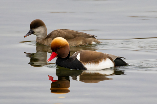
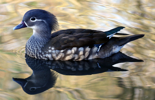
Citizen-science photos record 42 species at The Wildlife Habitat, including Chilean Flamingo, Brown Pelican, Red-crested Pochard, White-faced Whistling Duck and Mandarin Duck. Those with a page of their own in our atlas show the odds of seeing them in the wild.
Where can you see the animals of The Wildlife Habitat in the wild?
Chilean Flamingo: Lauca National Park
Some of the animals photographed at The Wildlife Habitat also live in the parks and cities we cover: Chilean Flamingo (about 50% of wildlife watchers report it on a given day in Lauca National Park), Brown Pelican (about 90% of wildlife watchers report it on a given day in Padre Island National Seashore) and Red-crested Pochard (about 30% of wildlife watchers report it on a given day in Fertő-Hanság National Park).
Does The Wildlife Habitat charge an entrance fee?
Free
The open map data for The Wildlife Habitat lists it as free to enter. It does not include ticket prices or any change since it was last edited, so check the official website before you go.
When is The Wildlife Habitat open?
Every day · sunrise to sunset
According to its open map listing, The Wildlife Habitat is open Every day · sunrise to sunset. Opening hours change with the season and on public holidays, so confirm them on the official website before you travel.
When did The Wildlife Habitat open and how big is it?
0.4 ha
The Wildlife Habitat, a zoo or wildlife park in Las Vegas, United States, covers about 0.4 ha, according to Wikidata and OpenStreetMap. Today 42 species are photographed there.
Nearest Zoos & Centres


Nearest Parks


Nearest Cities


Sources: © OpenStreetMap contributors (ODbL) · iNaturalist observers · the centre's official website