Zoo
Gazipur Safari Park
🇧🇩 Bangladesh
🦒 Zoo or wildlife park, Bangladesh 9 spp. present
Gazipur Safari Park or Safari Park, Gazipur is a safari park in Gazipur, Bangladesh. This safari park is spread over 3,810 acres (1,540 ha) of Sal Forest which makes it one of the largest safari parks in the world and the largest in Asia. It was inaugurated on October 31, 2013. It is located about 40 km (25 mi) north of Bangladesh's capital city Dhaka near the Dhaka — Mymensingh Highway. Wikipedia (CC BY-SA)
24.170° N 90.397° E
🎟️ Visit

Essentials
Entrance
—
Tourism
High
Species present
9
speciesOpened
2013
Size
Large
Visit
Who runs it
- Run by
- Forest Department
What visitors say
🦒 Animals in captivity





Before you go
Where is Gazipur Safari Park?
Bangladesh
Gazipur Safari Park is a zoo or wildlife park in Bangladesh. Its coordinates are 24.170° N, 90.397° E. The nearest national park in our atlas is Manas National Park, about 289 km away.
What animals can you see at Gazipur Safari Park?
9 species
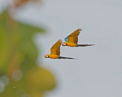
Citizen-science photos record 9 species at Gazipur Safari Park, including Common Peafowl, Nilgai, Red Junglefowl, Great White Pelican and Mallard. Those with a page of their own in our atlas show the odds of seeing them in the wild.
Where can you see the animals of Gazipur Safari Park in the wild?
Common Peafowl: Udawalawe National Park
Some of the animals photographed at Gazipur Safari Park also live in the parks and cities we cover: Common Peafowl (about 90% of wildlife watchers report it on a given day in Udawalawe National Park), Nilgai (about 80% of wildlife watchers report it on a given day in Keoladeo National Park) and Red Junglefowl (about 70% of wildlife watchers report it on a given day in Kaziranga National Park).
When did Gazipur Safari Park open and how big is it?
Opened 2013, 1,216 ha
Gazipur Safari Park, a zoo or wildlife park in Bangladesh, opened in 2013 and covers about 1,216 ha, according to Wikidata and OpenStreetMap. Today 9 species are photographed there.
Nearest Zoos & Centres


Nearest Parks


Nearest Cities


Sources: © OpenStreetMap contributors (ODbL) · Wikidata (CC0) · iNaturalist observers · Wikipedia (CC BY-SA)