Zoo
Bramble Park Zoo
🇺🇸 United States
🦒 Zoo or wildlife park, United States 12 spp. present
Bramble Park Zoo is located in Watertown, South Dakota. Open since 1912, the zoo comprises 15 acres (6.1 ha) with approximately 500 animals representing 130 different species. It is the second-largest zoo in South Dakota. The zoo is open year-round and takes extra steps to keep animals safe during South Dakota winters. Wikipedia (CC BY-SA)
44.909° N 97.127° W
🎟️ Visit

Essentials
Entrance
—
Tourism
High
Species present
12
speciesOpened
1912
Size
Medium
Visit
Opening hours
Every day · 10:00–16:00
Getting there
- Address
- 800 10th Street NW, 57201
What visitors say
🦒 Animals in captivity





Before you go
Where is Bramble Park Zoo?
United States
Bramble Park Zoo is a zoo or wildlife park in the United States, at 800 10th Street NW, 57201. Its coordinates are 44.909° N, 97.127° W. The nearest national park in our atlas is Badlands National Park, about 432 km away.
What animals can you see at Bramble Park Zoo?
12 species
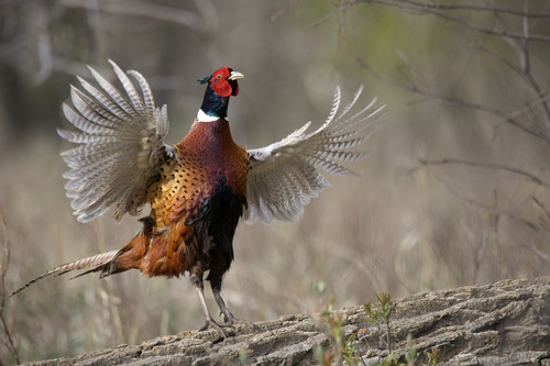
Citizen-science photos record 12 species at Bramble Park Zoo, including Red-tailed Hawk, Black-bellied Whistling-Duck, Canvasback, Sandhill Crane and Ring-necked Pheasant. Those with a page of their own in our atlas show the odds of seeing them in the wild.
Where can you see the animals of Bramble Park Zoo in the wild?
Red-tailed Hawk: Irazú Volcano National Park
Some of the animals photographed at Bramble Park Zoo also live in the parks and cities we cover: Red-tailed Hawk (about 50% of wildlife watchers report it on a given day in Irazú Volcano National Park), Black-bellied Whistling-Duck (about 70% of wildlife watchers report it on a given day in Palo Verde National Park) and Canvasback (about 10% of wildlife watchers report it on a given day in Elk Island National Park).
When is Bramble Park Zoo open?
Every day · 10:00–16:00
According to its open map listing, Bramble Park Zoo is open Every day · 10:00–16:00. Opening hours change with the season and on public holidays, so confirm them on the official website before you travel.
When did Bramble Park Zoo open and how big is it?
Opened 1912, 7.7 ha
Bramble Park Zoo, a zoo or wildlife park in the United States, opened in 1912 and covers about 7.7 ha, according to Wikidata and OpenStreetMap. Today 12 species are photographed there.
Nearest Zoos & Centres


Nearest Parks


Nearest Cities


Sources: © OpenStreetMap contributors (ODbL) · Wikidata (CC0) · iNaturalist observers · Wikipedia (CC BY-SA) · the centre's official website